|
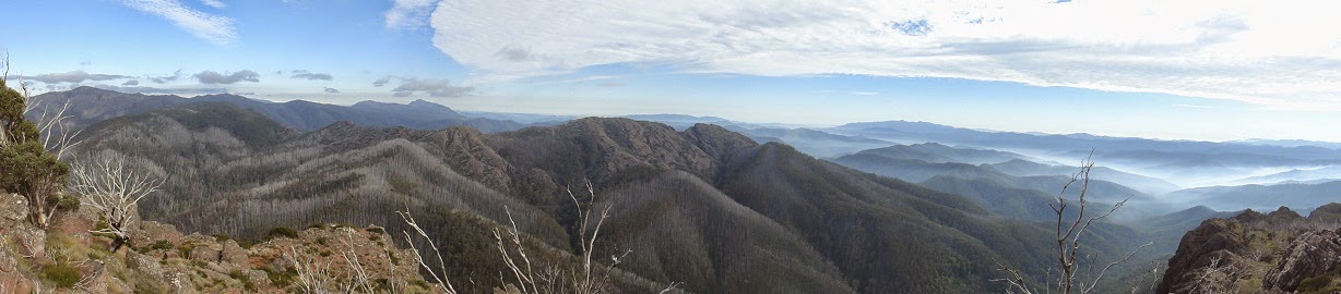
| Rock Table |
Studying the maps I decided to access the Hinces Saddle camping area via the Burrowa 4wd track. This would place me as close as I could get to Mt Burrowa and an easy walk back to Black Mountain. Black Mountain can be access by 2wd quite close to the summit via Black Mountain Track. For those without a suitable four wheel drive parking near Black Mountain and hiking into Hinces saddle would be an option.
 | |
| Hinces Saddle Camping area |
I arrived at the camping area around midday, popped lunch in the pack and headed of to Black Mountain, I was glad I had taken the time to research this track also, as the track was often hard to find in the scrub and the orange triangles were very internment.
 |
| Black Mountain Track is in there |
The 2.5km took around 90 minutes, the summit is treed and offers little views. The return trip took a similar amount of time albeit it a little easier with the gps track to refer to when the direction to walk was not obvious.
 |
| Some track markers |
There was a warning notice on the PV web site (and at the start of the Mt Burrowa track) indicating the track was not well marked and over grown and only suitable equipped hikers should attempt the Mt Burrowa track
.
 |
| PV warning sign |
Armed with the experiences of the Black Mountain trip I head off early, (0730) the section of track between Hinces Saddle and the turn off to Mt Burrowa whilst also poorly marked and hard to see an obvious foot pad on, with the relatively narrow ridge line did make navigation reasonably simple.
 |
| Track Junction |
About 2.5km from Hinces Saddle the track to Mt Burrowa heads off to the North West, from here it is a steep decent to the saddle and long slow climb up to the ridge that Mt Burrowa sits on. There are also big gaps between the orange triangle track markers through out this section and often no clear sign of a well-used foot pad.
 |
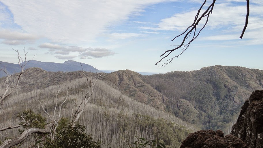
| Looking North West on Burrowa ridge |
After around 2km from the sign post you arrive at a large rock clearing this spot offers good views to the North. According to the topo maps this is not the highest point on the ridge, it is still another good 1Km past this point. Whilst I did head out to the actual highest point it is 2.5km return scrub bash to a rock cairn taking around 2 hours for the return trip. With the exception of the surprised goat, on the way, the summit offers no real views. I would suggest saving you time and energy and enjoy a long lunch here.
 |
| Burrowa Local |
The return trip, like the day before was a constant search for orange triangles, some sort of foot pad and referring to the GPS track from the trip out.
Conclusion, the round trip (walking time) was almost 9 hours; the GPS showed I walked just over 12km. So I believe that Parks Vic consider the spot with the good views to be the “summit” from a walkers perspective.
Also somewhere after leaving this spot I lost my watch, not a good watch, but not one I had planned to replace in a hurry.